Paddling along Florida’s 30A coastline is a great way to enjoy the water, but weather conditions can change quickly. To stay safe, you need reliable tools to monitor wind, tides, and storms. Here are the top 5 weather apps for paddlers:
- AccuWeather: Offers hyper-local forecasts, real-time precipitation updates, and severe weather alerts. Great for general weather tracking, though it lacks tide data.
- Windy: Focuses on detailed wind speeds, gusts, and tide information. Ideal for planning routes based on wind and tidal conditions.
- NOAA Weather Radar Live: Provides real-time radar and government-sourced severe weather alerts. Best for storm tracking.
- Tides Near Me: Delivers accurate tide predictions, including high/low tide times and tide heights. Perfect for timing launches and returns.
- MyRadar: Features animated radar and real-time storm tracking. Good for quick checks on rain and thunderstorms.
Quick Comparison
| App | Focus | Best For | Key Limitation | Price (as of 2025) |
|---|---|---|---|---|
| AccuWeather | Local weather updates | General weather monitoring | No tide info | Free/Premium: $3.99–$8.99/yr |
| Windy | Wind & tide data | Wind/tide-based planning | Complex interface | Free/Premium: $18.99/yr |
| NOAA Weather Radar Live | Radar & alerts | Storm tracking | Basic interface | Free/Premium: ~$10/yr |
| Tides Near Me | Tide predictions | Timing launches around tides | No weather data | Free |
| MyRadar | Animated radar | Quick storm checks | Limited wind/tide info | Free/Premium: ~$50/yr |
Combine these apps for a complete toolkit: use Windy for wind and tide details, Tides Near Me for tide timing, and MyRadar for storm tracking. Always check the weather before heading out and plan for safe conditions.
Best Marine Weather Apps
1. AccuWeather
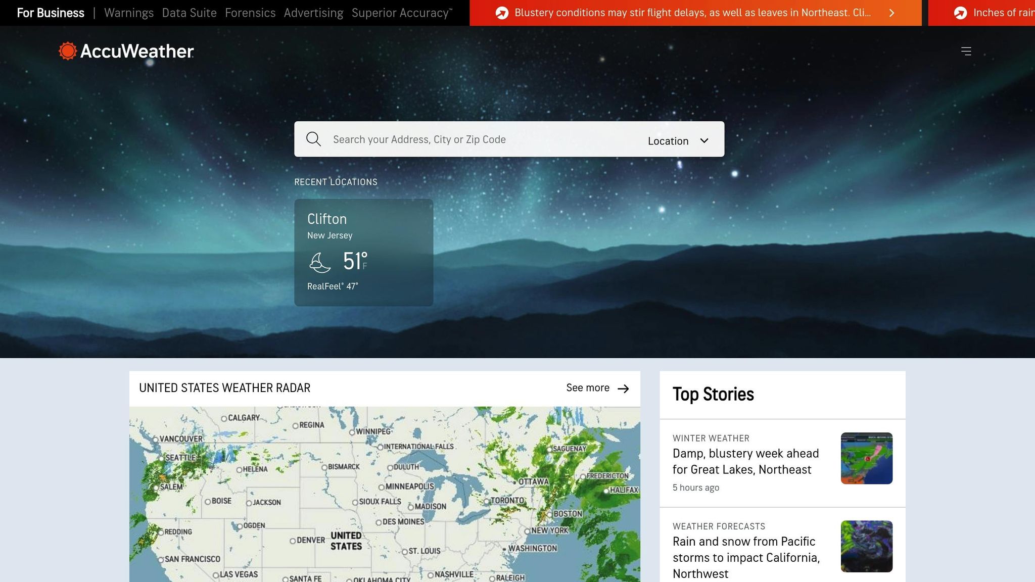
AccuWeather is a go-to weather app for 30A paddlers, trusted by millions around the world for its dependable and accurate forecasts. It provides the real-time weather information you need to make smart, safe decisions before heading out on the water.
Real-time weather updates
One of AccuWeather’s key strengths is its ability to deliver highly detailed, localized forecasts. You can check current temperature, humidity levels, precipitation, and radar imagery that updates throughout the day. The app’s MinuteCast feature is especially useful, offering minute-by-minute precipitation predictions to help you time your launch or return perfectly. For paddlers, this level of precision can make all the difference.
Wind and tide forecasts
AccuWeather also provides hourly and daily wind data, including speed and direction, so you can identify the best times for calm paddling conditions. However, it’s worth noting that the app doesn’t include comprehensive tide forecasts. To fill this gap, consider pairing it with a tide-specific app like Tides Near Me for a more complete planning toolkit.
Severe weather alerts
Safety is a top priority for any paddler, and AccuWeather’s customizable alerts are a standout feature. You’ll receive real-time notifications for severe conditions such as thunderstorms, lightning, and high winds, tailored to your exact location in South Walton. These alerts are especially critical during hurricane season, which runs from June through November, when storms and rough surf are more common along the 30A coastline.
Local relevance for South Walton
What sets AccuWeather apart for paddlers in South Walton is its hyper-local focus. The app is well-suited to the region’s microclimates and rapidly shifting coastal weather patterns. You can set up multiple location alerts to stay informed about conditions along your planned route. It’s no surprise that AccuWeather earns high marks from users, with a 4.6/5-star rating on the Apple App Store (based on over 2 million reviews) and a 4.4/5-star rating on Google Play (from over 2.5 million reviews) as of late 2025.
While the free version covers all the basics, upgrading to the premium subscription (around $3.99/month or $8.99/year) unlocks advanced features that can enhance your experience even further.
2. Windy
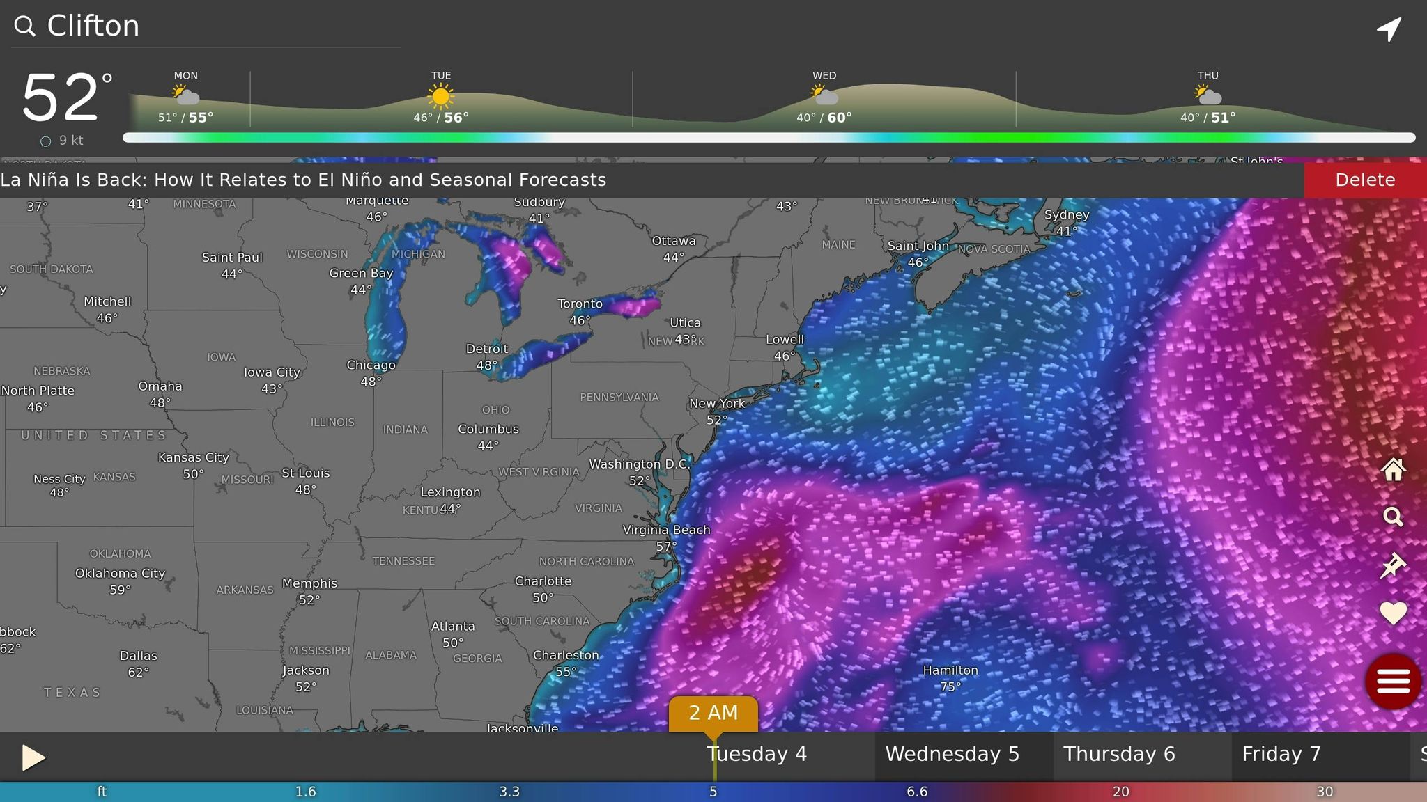
Windy stands out as a go-to app for paddlers, offering essential real-time weather data to ensure safe and well-informed trips along the ever-changing waters of 30A. With its detailed meteorological insights, Windy is a must-have tool for navigating South Walton's coastal conditions.
Real-time weather updates
Windy provides up-to-the-minute updates on critical weather factors like wind speed and direction, precipitation, temperature, and humidity. These data points are crucial for evaluating conditions before heading out, and Windy simplifies it all with intuitive visual overlays that make even complex weather patterns easy to understand. Coastal weather can change in the blink of an eye, but Windy’s continuous updates throughout the day allow paddlers to stay ahead of shifting conditions. Pair this with its tide information, and you’ve got a comprehensive safety toolkit for planning your paddling adventure.
Wind and tide forecasts
For paddlers, understanding wind behavior is key, and Windy excels in delivering precise data on wind speeds, gusts, and directions for specific 30A locations. This information is vital for avoiding unexpected strong winds that could disrupt your plans. What sets Windy apart is its inclusion of tide data, covering common tidal datums like LAT, MLLW, and MSL. This feature helps paddlers time their trips perfectly, avoiding strong currents or low tides that could leave them stranded along South Walton's shores.
Severe weather alerts
Safety takes center stage with Windy’s severe weather alerts, which provide timely notifications about storms, high winds, and precipitation. The app also displays weather fronts and isobars, making it easier to identify potentially hazardous conditions. With its ability to layer multiple weather elements on a single map, Windy lets users quickly distinguish between a passing rain cloud and a more serious weather system that might require immediate action.
Tailored for South Walton
Windy’s data isn’t just accurate - it’s tailored for paddlers exploring 30A. Its interactive map interface allows users to zoom in on specific locations along the coastline, including popular spots like Western Lake and Choctawhatchee Bay. Plus, the app integrates webcams, offering a visual check of conditions at your intended launch site before you even leave home. This feature is especially handy for exploring both familiar spots and the hidden gems that make South Walton so unique. For those looking to discover more secluded paddling routes, resources like sowal.co provide valuable local insights.
With a stellar 4.7/5 rating on both the Apple App Store and Google Play, Windy is widely praised for its accuracy, depth, and user-friendly design. The free version offers plenty of features, but for those craving extra detail, Windy Premium - priced at around $18.99 annually as of 2025 - unlocks hourly forecasts and additional data layers. Whether you’re a casual paddler or a seasoned explorer, Windy has you covered.
3. NOAA Weather Radar Live
For paddlers who value reliable, government-sourced weather data, NOAA Weather Radar Live is a go-to tool. This app connects directly to the National Oceanic and Atmospheric Administration's (NOAA) network, delivering weather updates that professionals trust.
Real-time weather updates
This app provides real-time radar imagery alongside current details on temperature, precipitation, and cloud cover. Whether you're planning a trip or already out on the water, you can monitor changing conditions with ease. The radar feature is especially useful for tracking rain and storms as they approach South Walton's coastline. Plus, the app allows you to save your favorite launch spots, giving you quick access to localized updates whenever you need them.
Severe weather alerts
Staying safe on the water is crucial, and NOAA Weather Radar Live helps by sending severe weather alerts straight to your device. These include warnings for thunderstorms, tornadoes, and floods, all sourced directly from the National Weather Service. With push notifications, you'll be informed of hazardous conditions immediately, giving you time to adjust your plans.
Local relevance for South Walton
For paddlers exploring the 30A coastline, this app stands out by offering localized weather data from stations across the Florida Panhandle. It works seamlessly with local resources like sowal.co to provide accurate updates tailored to the area. While NOAA Weather Radar Live excels at radar-focused weather tracking, it’s a good idea to pair it with apps like Windy or Tides Near Me for detailed wind and tide information, ensuring a well-rounded approach to safety and trip planning.
4. Tides Near Me
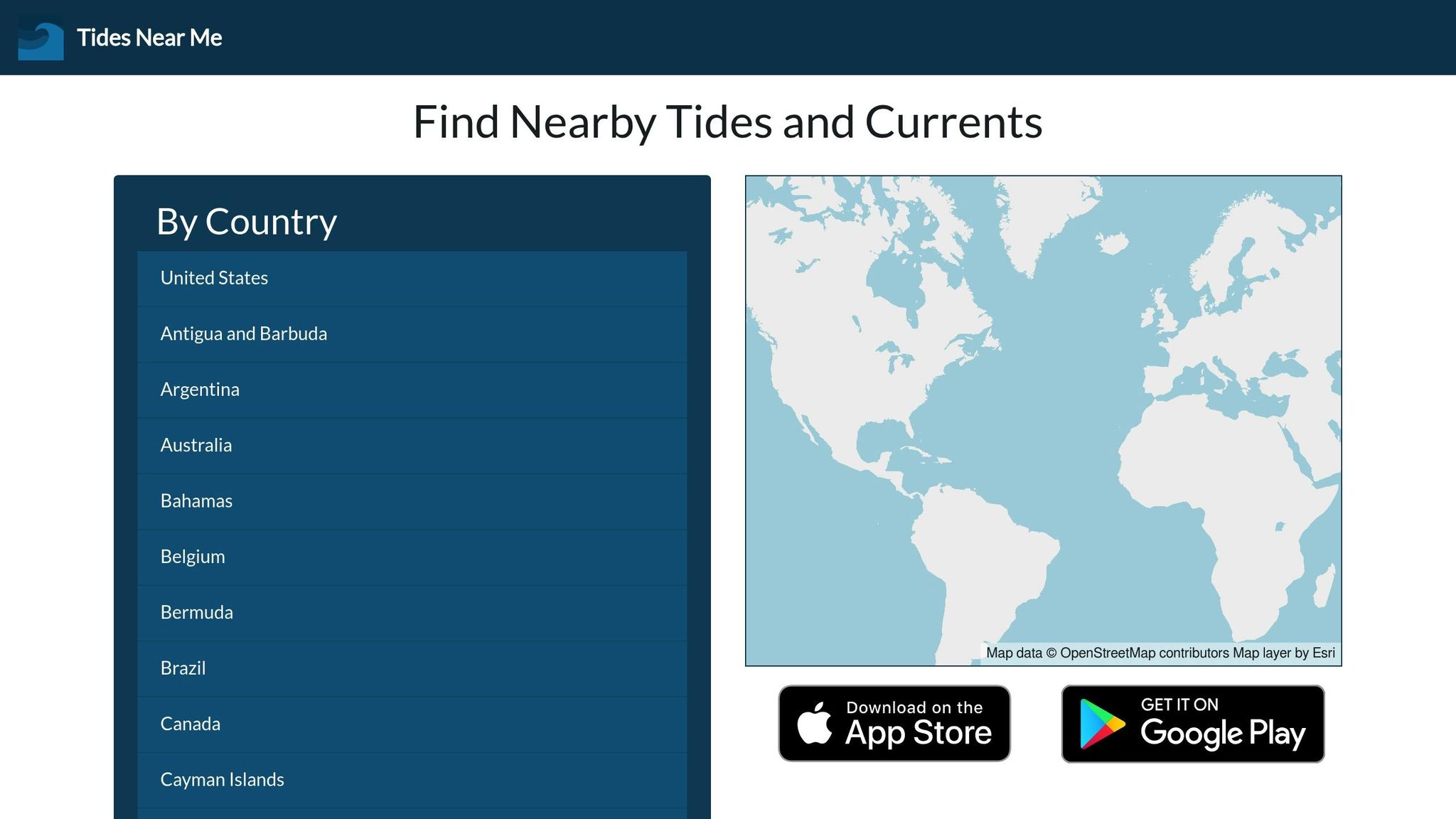
Tides Near Me is a must-have app for 30A paddlers, offering accurate tidal information tailored to your location. By automatically identifying the nearest tide station, it provides detailed data that can make a big difference in your paddling experience.
Wind and Tide Forecasts
This app delivers real-time tide predictions, including high and low tide times, as well as tide heights. These updates are essential for estimating current strengths along the coast. For paddlers venturing into spots like Western Lake or the waters near Seaside, knowing the tides can help you avoid strong currents in narrow channels and plan your route when water levels are most favorable.
Additionally, sun and moon phase data is included, which is especially helpful for organizing early morning or evening paddles. For wind conditions, pairing Tides Near Me with the Windy app provides a complete picture of water and wind forecasts, ensuring you're fully prepared.
Local Insights for South Walton
Accurate tide data is critical for paddlers in South Walton. By pulling information from official tide stations and NOAA, the app helps users identify the best times to launch and warns of potential hazards. With access to thousands of tide stations worldwide, it also covers the key locations around 30A.
One standout feature is its offline functionality, ensuring you can access tide data even when you're out of cell service range. This is especially useful for exploring less developed areas of the 30A coastline. Trusted local resources like sowal.co often recommend Tides Near Me for its ability to help paddlers understand local tide patterns and steer clear of common pitfalls.
For a smoother and safer paddling experience, plan your launch and return around high tide. This ensures calmer currents, deeper water, and easier access to your favorite spots.
sbb-itb-d06eda6
5. MyRadar
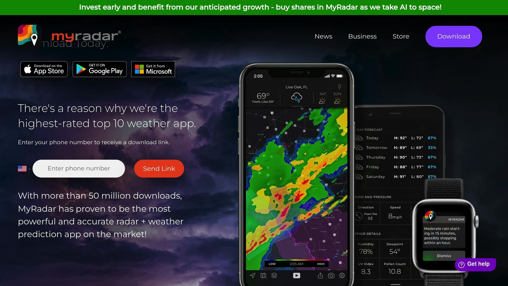
MyRadar has become a go-to weather app, boasting over 50 million downloads and consistently ranking among the top 10 in the U.S.. Its quick and precise radar imagery makes it an essential tool for kayakers and paddleboarders who need to make informed safety decisions while out on the water.
Real‑Time Weather Updates
MyRadar offers animated radar visuals that show precipitation, storm movements, and cloud cover in real time. This feature is especially useful for tracking rain and thunderstorms along the 30A coastline. Imagine a paddler launching from Grayton Beach - by keeping an eye on approaching rain cells, they can adapt their plans accordingly. Even in areas with patchy internet coverage, MyRadar’s low lag time ensures you stay updated without delays.
Severe Weather Alerts
The app provides customizable severe weather alerts sourced from the National Weather Service. These alerts cover thunderstorms, lightning, and tornado warnings, allowing users to tailor notifications to specific locations, like South Walton. This feature is particularly helpful for paddlers, offering timely warnings to steer clear of sudden storms while on open water. It combines real-time updates with location-specific insights, addressing the unique challenges faced by South Walton paddlers.
Local Relevance for South Walton
MyRadar’s detailed local mapping is a standout feature for South Walton. It allows users to quickly locate beaches, launch spots, and paddling routes along 30A. While it doesn’t include tide predictions, its wind speed and direction overlays are invaluable for assessing water conditions. For a more complete planning experience, you can pair MyRadar’s real-time updates with community resources like sowal.co, which offers insights and recommendations on launch sites.
Using These Apps for Safe Paddling and Trip Planning
Planning a paddling trip along the 30A coastline? Combining information from weather apps is key to ensuring a safe and enjoyable outing. Before you set out, take time to evaluate wind, tide, and weather conditions.
Start with Windy to check wind speeds at your launch site. Ideally, aim for wind speeds of 10 mph or less and avoid gusts exceeding 20 mph. If conditions look too windy, consider relocating to a more sheltered area, like Western Lake.
Next, turn to Tides Near Me to find the best high tide windows. High tides typically mean deeper water and calmer currents, which can make navigation easier and safer.
For weather updates, cross-check NOAA Weather Radar Live or AccuWeather to spot any incoming storms. If thunderstorms are in the forecast, it’s best to reschedule your trip for another day.
When planning your route, paddle into the wind on your way out, so you can return with the wind at your back. Use Windy’s directional arrows to map out the most efficient path for your journey.
Once you arrive at your launch site, take a moment to visually confirm the conditions. Look for indicators like flag movement, ripples on the water, or swaying trees to make sure the app data aligns with real-time observations. If conditions seem worse than expected, adjust your plans accordingly.
Always let someone know your route and expected return time. While on the water, keep an eye on MyRadar for any sudden weather changes that could affect your trip.
For more local tips and advice on launch points, check out sowal.co.
App Comparison Chart
Pick your weather app based on your specific needs and preferences. Each app brings something to the table, but they also come with their own set of limitations.
| App | Strengths | Limitations | Best Use Case | Ease of Use | Accuracy | 30A Relevance |
|---|---|---|---|---|---|---|
| AccuWeather | Hyper-local forecasts, minute-by-minute precipitation updates, severe weather alerts | Lacks detailed marine and tide information | General weather awareness and storm alerts | Easy | High | Moderate |
| Windy | Detailed wind speeds, gust data, multiple weather models, live webcams | Complex interface may overwhelm beginners | Planning routes around wind and storm conditions | Moderate | High | Very High |
| NOAA Weather Radar Live | Reliable government data, marine forecasts, storm tracking | Basic interface, less localized detail | Quick storm checks and official weather updates | Easy | High | High |
| Tides Near Me | Real-time tide predictions, offline functionality, sunrise/sunset data | No general weather forecasting | Timing launches and returns around tides | Easy | High | High |
| MyRadar | Fast animated radar, intuitive interface, real-time precipitation tracking | Limited wind and tide data | Quick rain and storm visualization | Very Easy | High | Moderate |
Here’s a closer look at what makes each app shine - and where they fall short.
AccuWeather delivers precise, hyper-local forecasts and real-time precipitation updates. It's great for storm alerts, but you’ll need a separate app for tide information.
Windy is a powerhouse for weather enthusiasts, offering detailed wind data, live webcams, and multiple weather models. While its depth of information is impressive, the interface can feel overwhelming to newcomers. It’s a favorite for those who need comprehensive wind and storm planning.
NOAA Weather Radar Live provides dependable, government-sourced data, making it a go-to for quick safety checks. However, it doesn’t offer the same level of localized detail as some other apps.
Tides Near Me focuses exclusively on tidal data, automatically pinpointing the nearest tide station and providing accurate predictions - even offline. That said, it lacks broader weather forecasting, so it’s best used alongside other apps.
MyRadar is all about speed and simplicity. Its animated radar and real-time precipitation tracking make it ideal for quick weather checks. However, paddlers needing detailed wind data for route planning may find it lacking.
Most of these apps offer free core features, which are sufficient for most paddlers. For those looking for more advanced tools - like extended forecasts or ad-free experiences - premium subscriptions typically cost $8–$10 per month or around $50 annually.
For a well-rounded safety toolkit, consider combining Windy for wind data, Tides Near Me for tidal timing, and MyRadar for storm tracking. Together, they cover all the essentials.
Conclusion
Exploring the waters of 30A can be an incredibly rewarding experience, but staying safe requires preparation. Using multiple weather apps is a smart way to stay informed and avoid potentially dangerous situations.
By comparing data across different apps, you can spot inconsistencies and get a fuller understanding of shifting conditions. Weather can change quickly - calm waters in the morning might turn choppy by afternoon. Keeping an eye on updates throughout the day helps you identify patterns and make smarter decisions as you gain more experience.
While weather apps are essential, they don't tell the whole story. Local knowledge is a key part of any safety plan. For example, resources like sowal.co offer valuable information about launch spots and areas that are safer for paddling when ocean conditions are less favorable. Their "Where the Locals Go" section is a great starting point for discovering hidden gems to complement your research.
Make it a habit to combine weather app data with local insights before heading out. This routine not only keeps you safe but also helps new paddlers develop the skills to read conditions and make sound decisions over time.
FAQs
What should you look for in a weather app when planning a paddling trip along the 30A coastline?
When choosing a weather app for paddling along the 30A coastline, prioritize features that deliver precise wind conditions, wave height details, and thunderstorm warnings. These are key to staying safe and making the most of your time on the water.
The best apps provide real-time updates, reliable marine forecasts, and easy-to-navigate designs. It’s also a bonus if the app includes tide schedules and water temperature information to help you plan your outing more effectively.
What’s the best way to use multiple weather apps to ensure safe paddling conditions?
To have a safe and enjoyable paddling trip, it’s a smart idea to use several weather apps to get a fuller picture of the current and upcoming conditions. Start with a general weather app to check the basics like temperature, rainfall chances, and wind forecasts. Then, turn to a marine-focused app for details on tides, wave heights, and water conditions. For real-time weather changes, a radar app can be invaluable, especially for tracking storms or sudden shifts in the weather.
By comparing information from these different sources, you’ll have a better grasp of the conditions and can minimize risks while on the water. Safety should always come first - if the weather looks uncertain or dangerous, it’s best to hold off on paddling.
Why should paddlers in South Walton use both tide-specific and general weather apps?
Using both tide-tracking and weather apps is a smart move for paddlers exploring South Walton. Tide apps keep you informed about water levels and currents, helping you plan routes that steer clear of strong tides or shallow spots. Meanwhile, weather apps deliver updates on wind speeds, temperatures, and the possibility of storms - factors that can greatly affect your paddling experience.
By combining these tools, you’ll have a better understanding of the conditions, making it easier to pick the ideal time and place for paddleboarding or kayaking along the scenic 30A coastline.