Highway 30A in South Walton County, Florida, has transformed from isolated settlements into a thriving coastal destination over the past 50 years. Initially accessible only by sand trails, the construction of Highway 30A in the mid-20th century and the rise of planned communities like Seaside in the 1980s played key roles in shaping the region. Today, 30A attracts millions of visitors annually, blending modern tourism with efforts to protect its natural beauty, including state parks, coastal dune lakes, and strict development guidelines. This balance between growth and preservation defines 30A's unique appeal and ongoing legacy.
30A: The Story of the Road (Part 1)
Early History: Native Heritage and First Settlements
Long before the scenic Highway 30A became a sought-after destination, South Walton County was home to thriving Native American communities. Archaeological discoveries reveal a deep, ancient heritage that shaped the area’s early identity. These early settlements laid the groundwork for the region’s eventual transformation into the planned communities we see today along 30A.
Native American History
Between 1000 and 1500 CE, the Fort Walton culture, an offshoot of the Mississippian tradition, thrived in the area. They developed advanced agricultural techniques, built complex social systems, and constructed ceremonial mounds. Archaeological evidence along the 30A corridor points to permanent settlements, ceremonial sites, and innovative fishing methods that made full use of the region’s abundant marine resources.
One of the most prominent examples of their achievements is the Indian Temple Mound in nearby Fort Walton Beach. This structure served as a central ceremonial and gathering place, showcasing their architectural skill. Smaller mounds and village sites dotted the landscape along what would later become the 30A corridor.
When Spanish explorers arrived in the 1500s, they encountered these established indigenous communities. By the 1700s, European influence began to reshape the region. Creek and Seminole tribes also utilized these coastal areas, often during seasonal migrations and fishing trips.
First Settlements Along Choctawhatchee Bay
As European settlers arrived, they built upon the foundation left by indigenous communities. Early settlements along Choctawhatchee Bay were shaped by the area’s natural resources. In the 1840s, a timber boom brought settlers like the Butler family, whose homestead eventually grew into Grayton Beach. Seasonal fishing camps, with their simple stilted wooden structures, became a hallmark of coastal architecture that influenced future designs.
During the Civil War, South Walton played a key role in supplying Confederate forces with salt, fish, and timber through small, efficient salt works.
By the 1880s, small communities like Seagrove began to emerge. The arrival of the DeFuniak Springs railroad connected the area to broader markets, facilitating the trade of local goods.
These early settlements set the tone for what would become the 30A communities of today. Their emphasis on integrating with the natural environment, prioritizing water access, and fostering close-knit communities remains a defining characteristic of the region’s modern towns.
Building 30A: Roads and Bridges
Transforming South Walton's coastal communities from scattered, isolated settlements into a connected region required the construction of durable roads and bridges. These efforts laid the groundwork for the growth and cohesion of the 30A area.
From Sand Trails to Highway 30A
Before the 1930s, traveling between coastal communities involved navigating rough sand trails that were often rendered useless during storms. These rudimentary paths linked small fishing camps and settlements but severely limited accessibility and growth.
The creation of Highway 30A in the 1930s marked a significant turning point. Initially, the road was little more than an upgraded sand trail, prone to poor conditions during rainy weather. However, it provided a foundation for future development.
The real breakthrough came in the 1960s with paving projects. By 1960, County Road 30A was fully paved, establishing the first continuous, reliable route between the coastal communities. This improvement not only made transportation easier but also set the stage for long-term development and the rise of tourism in the region.
Connecting Communities with Coastal Bridges
While the main highway served as the backbone, bridges became the vital links that truly connected the 30A communities. The region’s unique geography - featuring coastal dune lakes and bayous - necessitated numerous water crossings, which presented both technical challenges and opportunities.
One key example is the Oyster Lake Bridge in Dune Allen Beach. Completed as part of the 1960 paving of County Road 30A, this bridge connected areas divided by Oyster Lake. Later updates, like a culvert replacement in 2014 to restore salinity and the addition of a footbridge for pedestrians, further enhanced its utility.
Another early crossing point was the Hogtown Bayou log-board bridge in Santa Rosa Beach. This basic yet essential structure spanned Hogtown Bayou between 13th Street and County Road 393 North. It played a crucial role in linking early settlements, highlighting the importance of water crossings in fostering community connections.
Bridges not only improved transportation but also brought communities closer together by enabling the exchange of goods, services, and ideas. These crossings helped small fishing camps evolve into thriving coastal communities by providing access to infrastructure and essential services.
The economic benefits of bridge construction were immediate. Areas once reachable only by boat or hazardous trails became accessible for development. Property owners could transport building materials with ease, and visitors found it far simpler to travel between beach communities. This accessibility laid the foundation for the tourism industry that would later define the region.
Building bridges in this environment required innovative engineering to withstand harsh conditions like salt air, storm surges, and shifting sands. At the same time, these structures had to maintain natural water flow between the Gulf of Mexico and the coastal dune lakes - a balance that continues to be critical for the area's ecological health today.
Community Growth: Mid-Century Changes
The mid-20th century saw major transportation advancements that transformed the once-remote 30A area. These changes connected isolated settlements, making the region more accessible and paving the way for the charming beach communities we recognize today.
The Beginnings of Grayton Beach, Dune Allen, and Seagrove
With improved transportation, distinct communities began to take shape along the 30A corridor. Grayton Beach transitioned from informal fishing spots into a laid-back coastal community with a welcoming vibe. Dune Allen grew around key travel routes, while Seagrove became a popular spot for both seasonal visitors and permanent residents. Each town developed its own personality, influenced by the surrounding environment and the evolving needs of its people.
Shifts in Architecture and Daily Life
As these communities grew, so did their architectural and lifestyle choices. Simple, temporary cottages gave way to more permanent and sturdy homes. This change mirrored a shift in the local economy, moving away from traditional fishing toward tourism and service-based businesses. The formation of local institutions and organizations further strengthened the identity and unity of these blossoming towns.
sbb-itb-d06eda6
The Seaside Effect: New Urbanism and Regional Change
In the early 1980s, coastal planners along 30A introduced a bold approach to community design. Drawing from the area's history of connecting people through roads and bridges, they envisioned compact, walkable neighborhoods that stood in stark contrast to sprawling resort developments. This fresh perspective reshaped how communities were built, laying the foundation for what would eventually be called New Urbanism. At the heart of this transformation was Seaside, a community that became the blueprint for this new way of thinking.
Seaside: The Start of Something Different
Seaside was one of the first communities on 30A to bring this vision to life. Its design took cues from traditional Southern towns, featuring pedestrian-friendly streets, welcoming public spaces, and a tightly-knit center that encouraged daily interactions. The town's layout combined the charm of local coastal architecture with practical environmental considerations, ensuring both functionality and beauty. Unlike sprawling resorts, Seaside prioritized a compact design that made everything accessible while preserving the area’s unique character.
New Urbanism Takes Root Along 30A
Seaside’s success inspired a wave of change across the 30A region. Other communities began embracing its focus on walkability and mixed-use spaces, incorporating interconnected streets and housing options that catered to both locals and visitors. Over time, these ideas became more than just trends - they were officially integrated into regional planning policies. This shift not only boosted economic activity but also redefined how sustainable coastal communities were built, creating neighborhoods that balanced livability with long-term growth along 30A.
Modern 30A: Growth and Conservation
The evolution of 30A has been deeply influenced by New Urbanism, which brought together the rapid rise of tourism with a strong commitment to preserving the environment. Over the years, small beach towns have grown into a destination where thriving tourism exists alongside efforts to protect the area's natural beauty. Today, modern 30A faces the ongoing challenge of balancing economic growth with environmental conservation. This transformation has reshaped the region's economy, driven by tourism, which we'll delve into below.
Tourism Growth and Economic Impact
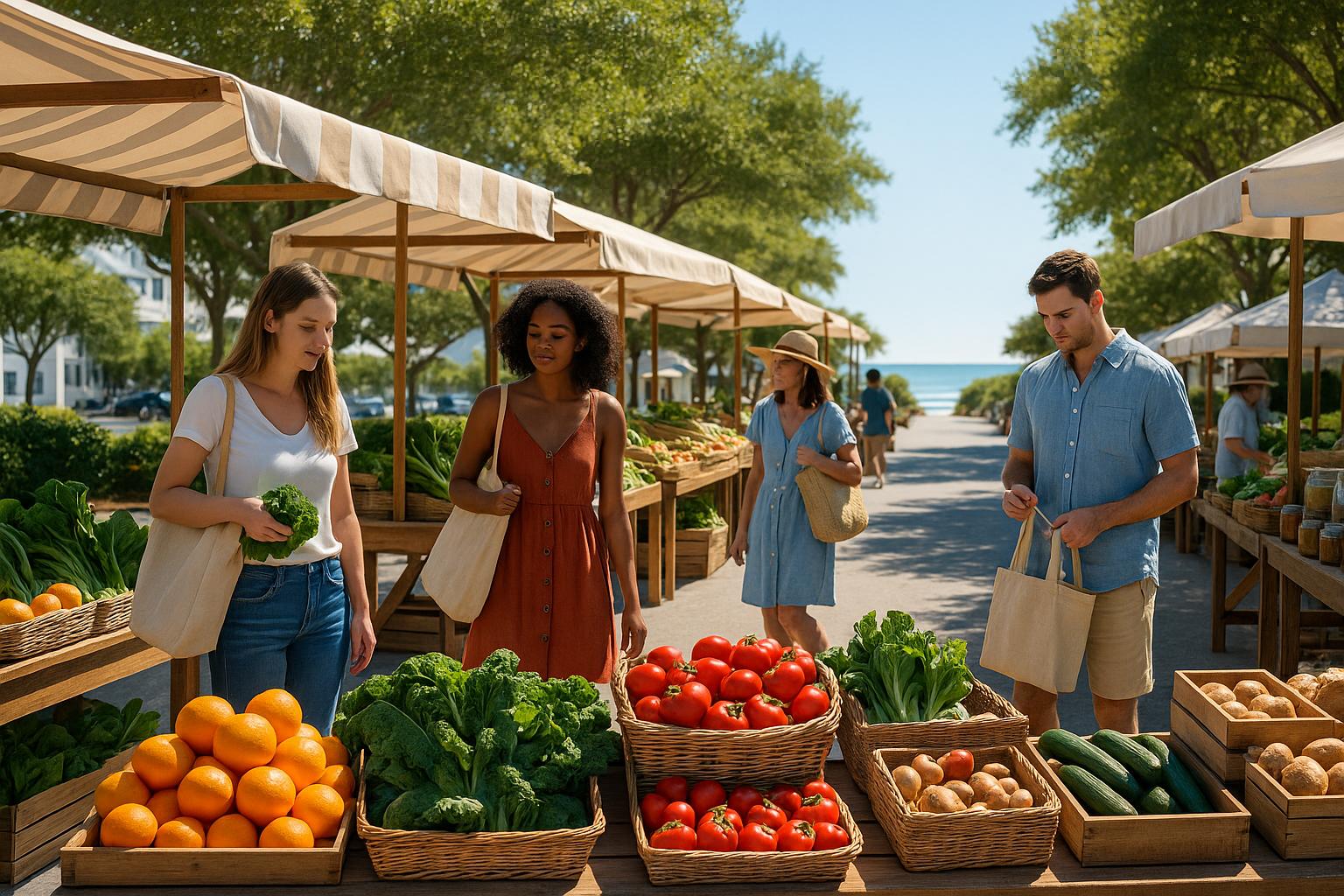
The late 1990s and early 2000s were pivotal years for 30A's tourism scene. Vacation rentals turned once-quiet neighborhoods into lively hubs during peak seasons. Platforms offering short-term rentals gave visitors a more personalized way to experience the area, often choosing beach houses over traditional hotels.
This shift brought new economic opportunities. Property owners benefited from rental income, while local businesses like restaurants, boutiques, and service providers adapted to meet the demands of both seasonal visitors and an increasing number of year-round tourists. The tourism boom also led to higher property values, more construction and hospitality jobs, and additional tax revenue that funded infrastructure upgrades.
But with growth came challenges. Traffic congestion on the narrow, two-lane Highway 30A became a recurring problem during busy seasons. Parking shortages at popular beaches occasionally created friction between residents and visitors. In some areas, the community's character began to change as commercial development expanded to accommodate the influx of tourists.
Protecting the Natural Area
The surge in tourism also highlighted the need for strong conservation efforts. Starting in the 1990s, local authorities implemented measures to protect 30A's unique environment. Grayton Beach State Park became a model for balancing public access with ecosystem preservation, showcasing how conservation could coexist with recreation.
Point Washington State Forest played a critical role in protecting over 15,000 acres of coastal habitats, including the rare coastal dune lakes like Western Lake and Deer Lake. These lakes, unique to the region, are among 30A's most treasured natural features.
Topsail Hill Preserve State Park added another layer of protection, safeguarding untouched beaches and dunes from development. Meanwhile, stricter local regulations were introduced to preserve the area's character. These included rules for greater beach setbacks, height limits for buildings, and maintaining native vegetation. Special guidelines were also enacted to protect the coastal dune lakes, limiting fertilizer use and requiring natural buffers along their shorelines.
The designation of the 30A corridor as a scenic highway further reinforced these efforts. Design standards ensured the road maintained its two-lane charm, while controlled street lighting helped protect the dark skies essential for sea turtle nesting. Architectural guidelines encouraged building designs that blend with the coastal environment.
These conservation initiatives have created a foundation for sustainable tourism. Visitors can explore 30A's beauty through state parks, nature trails, and protected beaches, all while new developments are carefully regulated to minimize environmental impact. For more tips on experiencing the balance between growth and preservation along 30A, check out sowal.co.
Conclusion: Looking Back at 30A's Changes
The journey of 30A, from its origins as Native American settlements and quiet fishing villages to its status as a sought-after coastal destination, tells a story of transformation and resilience.
What stands out is the thoughtful progression from the early Choctawhatchee Bay communities to the lively beach towns we know today. This growth has been shaped by a commitment to preserving the area's natural beauty while fostering economic vitality. The introduction of New Urbanism in the 1980s, particularly in Seaside, showcased how development could complement rather than compromise the environment, with walkable, mixed-use neighborhoods setting a standard for responsible coastal planning.
Today, 30A continues to balance its growth with conservation. Policies like building height restrictions and beach setbacks are examples of how the region prioritizes sustainability while catering to tourism. These measures ensure that development along the corridor respects the delicate coastal ecosystem, creating a blueprint for future progress.
The history of 30A demonstrates that sustainable growth isn’t just a possibility - it’s a reality when guided by a clear vision. Each generation has played a role in protecting the area’s unique coastal heritage. As 30A evolves, the lessons of the past provide a valuable guide for addressing modern challenges and embracing future opportunities, proving that development and nature can thrive side by side.
FAQs
How did the construction of Highway 30A shape South Walton County into a popular tourist destination?
The creation of Highway 30A during the late 1950s and early 1960s was a game-changer for South Walton County, turning it into a bustling tourist destination. This picturesque coastal road provided easier access to the area, drawing visitors with its convenient path and breathtaking scenery.
With improved connectivity, the region saw a wave of development, including resorts, vacation homes, and local businesses. Over the years, South Walton gained recognition for its upscale accommodations, immaculate beaches, and lively community, establishing itself as a top spot along Florida’s Gulf Coast.
How has New Urbanism shaped the growth and character of 30A towns over the years?
New Urbanism has been instrumental in crafting the charm and character of 30A towns. This planning philosophy prioritizes walkable neighborhoods, distinctive architectural styles, and a deep sense of community. You can see these principles come to life in places like Seaside, Florida, where vibrant, pedestrian-friendly areas seamlessly combine homes, businesses, and recreational spaces.
Even today, New Urbanism continues to influence how 30A evolves. Local planning efforts aim to balance growth with environmental care while preserving the area's small-town vibe. This thoughtful approach ensures 30A remains an inviting and well-designed destination for both residents and visitors.
How is tourism growth being balanced with environmental conservation along 30A?
Efforts to ensure tourism along 30A grows without compromising its natural beauty focus heavily on protecting habitats and encouraging sustainable practices. Local projects include restoring watersheds and coastal dune lakes, conducting regular water quality tests, and raising community awareness about conservation. Walton County also promotes eco-friendly landscaping, efficient water use, and encourages visitors to adhere to Leave No Trace principles.
Visitors can participate in eco-tourism activities such as hiking, paddleboarding on the dune lakes, or engaging in turtle conservation programs. These activities are designed to let people enjoy the area's stunning environment while minimizing their impact. All these measures work together to safeguard 30A's unique ecosystem and promote responsible tourism for generations to come.